| Survey Metadata | |
|---|---|
| Data Collector: | Eli Kersh |
| Survey Time Stamp (UTC): | 2026 May 29 - 21:18 |
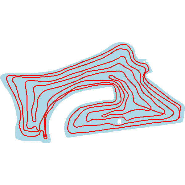
| Starting Location: | 38.083104, -122.513154 |
| Ending Location: | 38.083354, -122.514116 |
| Distance | 9.186 miles |
| Survey Statistics | |
|---|---|
| Average Water Temperature: | 73.6 °F |
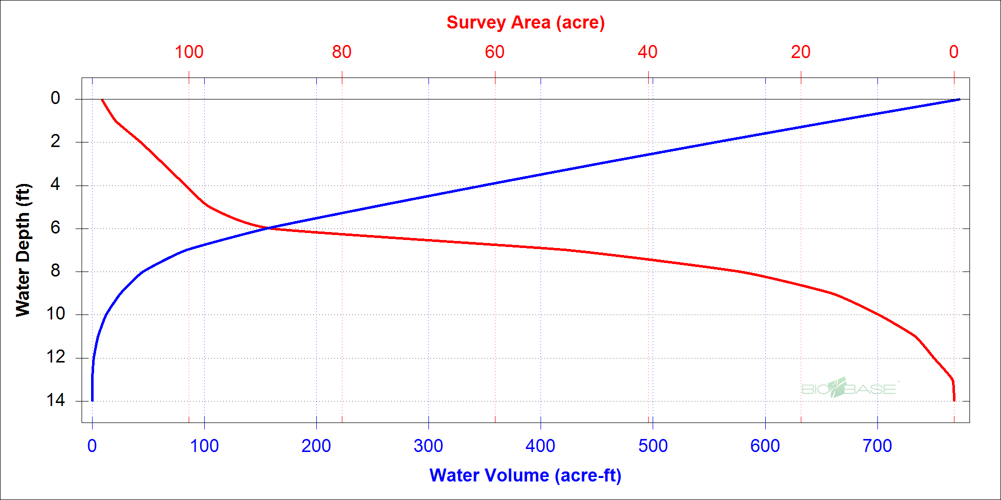
| Survey Area: | 111.430 acres |
| Survey Volume: | 773.714 acre ft |
| Percent of Waterbody Surveyed: | 97.1% |
| Waterbody Area: | 114.721 acres |
| Estimated Waterbody Volume | 796.562 acre ft |
| Survey Settings | |
|---|---|
| Includes Edited Data: | No |
| Track Buffer: | 25 m |
| BV Grid Cell Size: | 5 m |
| BV Minimum Detection - Percent: | 5.0% |
| BV Minimum Detection - Depth: | 2.400 ft |
| BV Maximum Detection - Depth: | 20.000 ft |
| BV Sonar Channel: | Primary |
| Quality Control | |
|---|---|
| Reviewer: | Ian McCormack |
| Comments: | We have reviewed this trip. Please use the "ASK THE EXPERTS" button for this trip if you have any questions. |