| Survey Metadata | |
|---|---|
| Data Collector: | Ray Fish Tester |
| Survey Time Stamp (UTC): | 2022 October 13 - 17:38 |
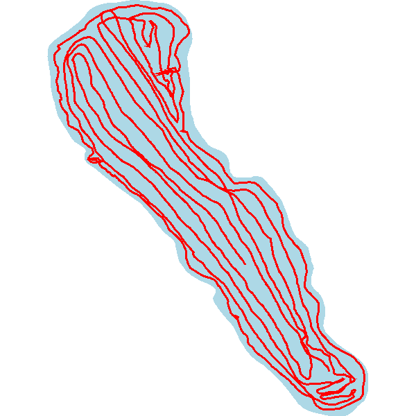
| Starting Location: | 44.836155, -93.125411 |
| Ending Location: | 44.837637, -93.126568 |
| Distance | 4.634 miles |
| Survey Statistics | |
|---|---|
| Average Water Temperature: | |
| Survey Area: | 20.582 acres |
| Survey Volume: | 131.625 acre ft |
| Percent of Waterbody Surveyed: | 100.0% |
| Waterbody Area: | 20.583 acres |
| Estimated Waterbody Volume | 131.628 acre ft |
| Survey Settings | |
|---|---|
| Includes Edited Data: | No |
| Track Buffer: | 25 m |
| BV Grid Cell Size: | 5 m |
| BV Minimum Detection - Percent: | 5.0% |
| BV Minimum Detection - Depth: | 2.400 ft |
| BV Maximum Detection - Depth: | 30.000 ft |
| BV Sonar Channel: | Primary |
| Quality Control | |
|---|---|
| Reviewer: | Ian McCormack |
| Comments: | We have reviewed this trip. Please use the "ASK THE EXPERTS" button for this trip if you have any questions. |